Here one day, gone the next

As many of you now know, last week was rather a hectic and interesting one in our lives.

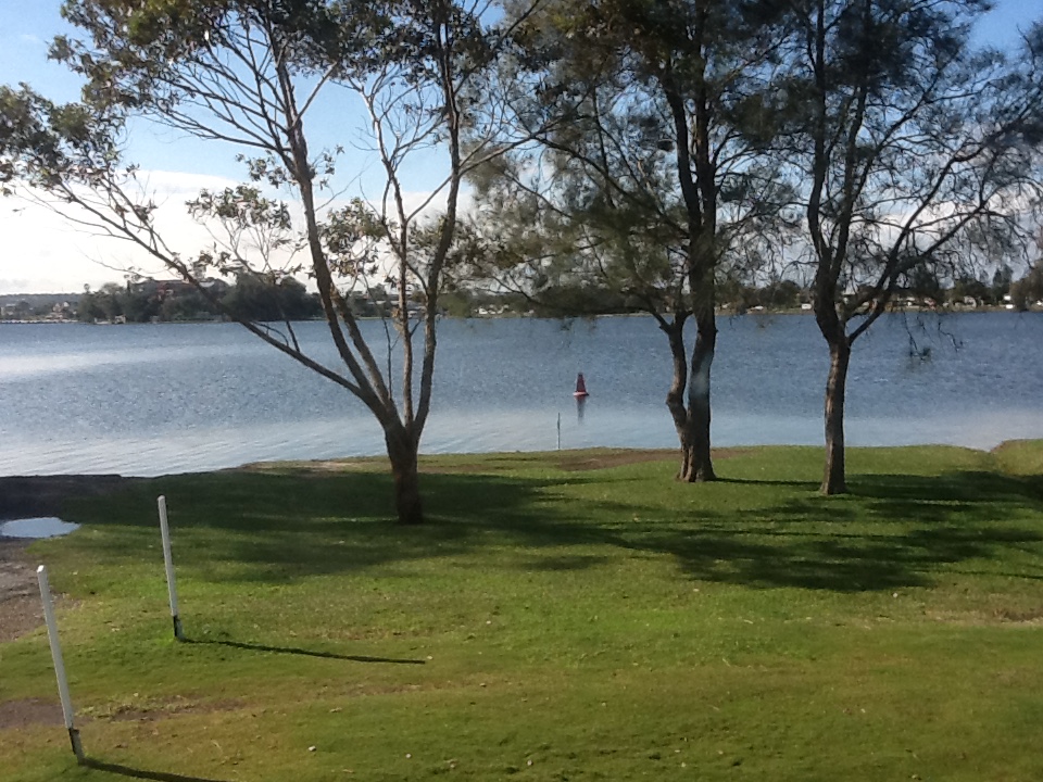
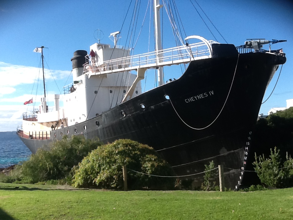
On Monday as planned, we packed ready for the road, first taking the Winnebago into Avida for its ‘house’ service. We enjoyed the morning walking around the waterfront, including watching the retiring navy ship HMAS Tobruk on her final journey, before returning to the service centre to pay the account and continue on our journey north to Mooloolaba.

HMAS Tobruk

HMAS Tobruk

And surprise of all surprises, they must have liked our home on wheels, as an offer that was too good to refuse was made to purchase her…..so what do you do! We had planned on 3 months in Cotton Tree (Maroochydore) enjoying a relaxing yet outdoor active time in the motorhome. But plans are made to be changed aren’t they! Having met a number of travellers who have told us how hard it can be to sell large motorhomes in today’s market, and visited other dealers and seen the same as ours that have sat in yards for 18 months plus without selling, we gladly accepted the offer. Then it was all go. We hired a 4 wheel drive, and along with the Suzuki we spent 2 hours of daylight and the evening packing everything we could that we could get in. And isn’t it surprising how much you can get in when you really try. Unfortunately though we had to leave a lot, but other than food, it was mainly household items that we now wouldn’t use, given we don’t expect to be motor-homing again anytime soon.

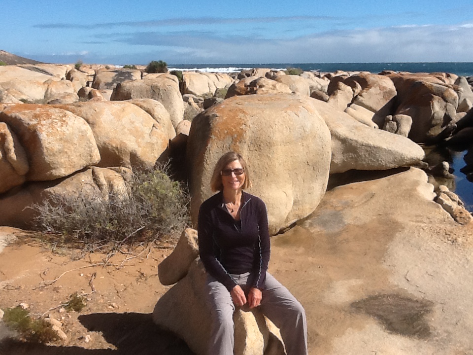
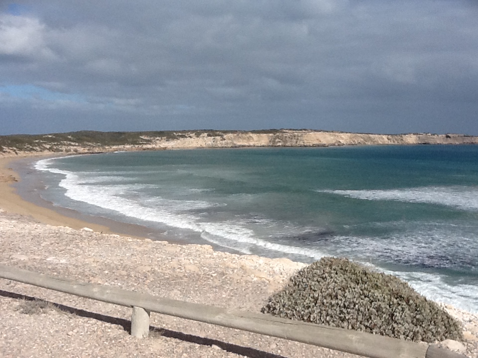
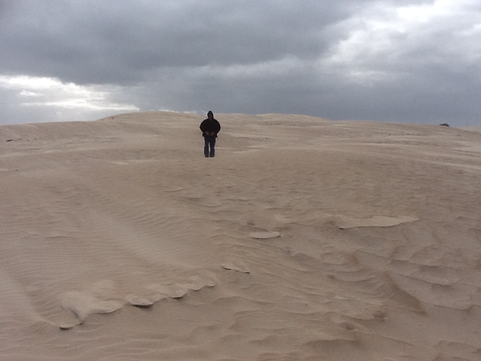
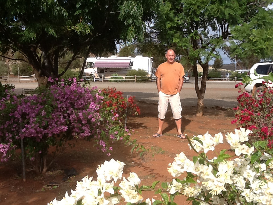
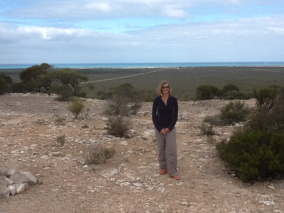
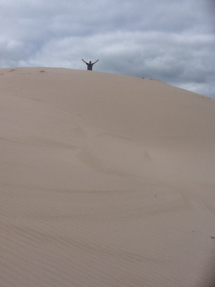
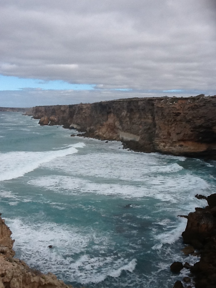
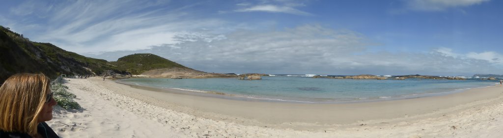
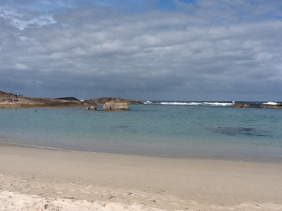
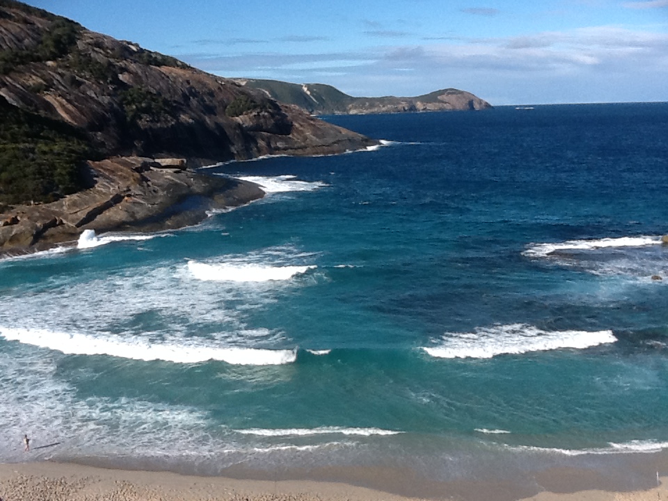
We have been asked how much we enjoyed our time on the road. That’s a simple one to answer. Absolutely! We have met some super people, some are now good friends. We’ve been to some stunning places, made even more interesting by some of the more average ones along the 24,000kms we travelled. If we had to rate our 3 separate trips, the stand out would have to be last year, time spent in NT and WA, there are too many fabulous places to mention them all, but the winner is Karajini National Park, followed closely by the Kimberley region. We have loved places where we are climbing, walking, flying, driving and swimming whilst taking in the beauty, and these two certainly offer all of these and more. And, we shared much of this time with 2 sets of great kiwis who enjoy themselves as much as we do.

After a strange last evening in the yard of Winnebago (not really a salubrious over night stay) we said goodbye and thank you for being such a reliable and safe vehicle having taken us on a trouble free journey around Australia and up through the middle over the last 2 years. 8am Tuesday morning we hit the road, and in convoy, with me driving the Suzuki and Steve the lovely new hire car we were on our way, our motorhome trip at an end.

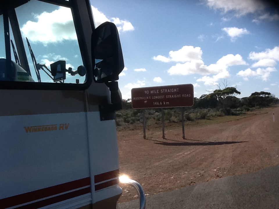
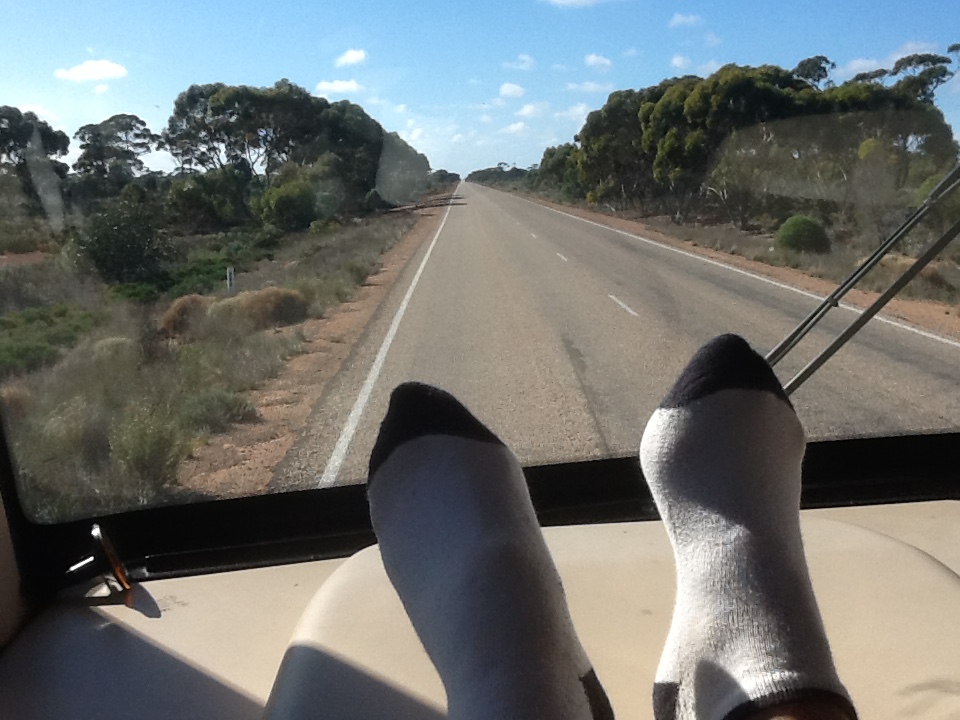
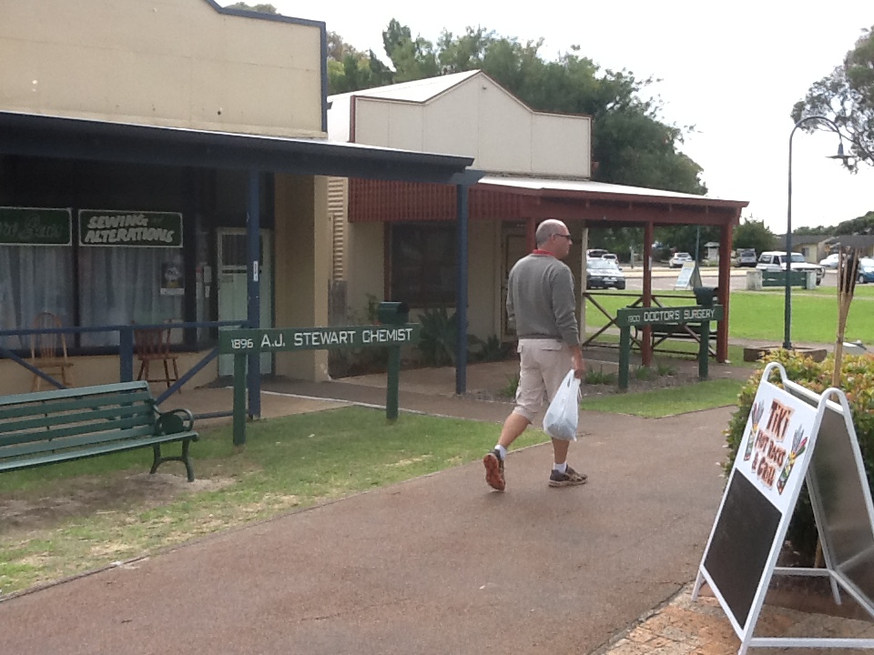
We intentionally broke the 1100km trip into 3 days, one long and 2 short. Our first stop was at the little town of Ulmarra, on the Clarence River and just north of Grafton. The whole village is classified by the national trust and is just like going back in time, as one of the best examples of a 19th century Australian river port. We had been recommended the B and B there, where an evening meal is provided by the very welcoming hosts. After a comfortable evening, on Wednesday we set off to Kingscliff, a lovely coastal beach south of Tweed Heads. Just as we arrived rain set in, so our beach stop over was a wet one, making it a great afternoon for laundry and relaxing before a very pleasant meal out. Waking to a fine morning and warm temperatures our final leg brought us here to Maroochydore. And oh what a pleasant feeling as we drove into Mooloolaba and along the waterfront to Maroochydore.

Because we had planned to be here in our motorhome and for only around 3 months, a short time ago we had made the decision to extend our tenants lease on our apartment……so yes, we could be tagged as homeless. Thinking it would be so easy to find long term holiday lets we hadn’t worried too much until Wednesday when we had started calling around various places, only to learn those darned kiwis have booked everything. Direct flights started again on Friday and there are apparently over 5000 coming in from Christchurch alone. We managed to get a quiet apartment a couple of streets back from the water for 2 weeks whilst hunting for longer term, and thankfully, whilst out for a Saturday beach walk we spotted a vacancy sign on the  beach front  where a cancelation had just been taken, so we are in once our 2 weeks finish here. What a relief. Its a bit of a bummer though when we keep walking passed our place and can’t wait to get in there.

We’ve enjoyed a couple of long beach walks in the sun and today we checked out  the development at Maroochydore near our apartment. We now have an amazing choice of restaurants to walk to, as well as a fantastic new shopping centre that includes farmers markets 3 days a week, and once a month, street evening markets. I think we could get to really enjoy our time here.

Yesterday we wandered through the camp ground for a nose to see if we could spot anyone we knew, and sure enough, friends from 2 years ago, with whom we maintain contact had just checked in on Saturday for 2 weeks, on their way to Cairns. So it was afternoon coffee and catch-up for the rest of the afternoon. We’ll see more of them over the coming days.  And believe it or not they are very interested in buying our Suzuki and hitch as they too have a motorhome, but no car.

So folks, blogs are now on hold for a while, until we start our next adventure. There isn’t anything planned at present, other than a quick trip back over the ditch to look at property….apparently its a bit cold in NZ so we won’t be there for too long, the warmer weather is too good to miss over here. Farewell from us and we will back on line when we next travel. There is a big world out there beckoning us!

Last sunset in the bus - Farewell!

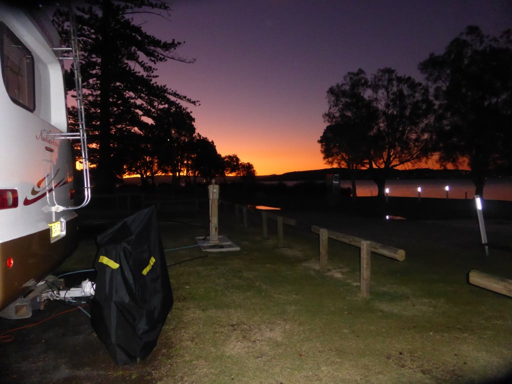
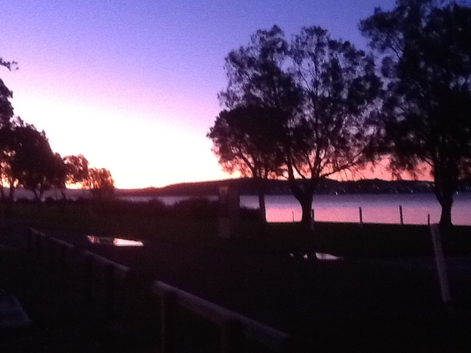
Last sunset in the bus – Farewell!


Have we really achieved much this week?

After waiting for Sydney’s peak hour traffic to end, we gingerly departed Vineyard, heading for the M7, M2 and Pennant Hills Road so we could head north on the M1. I say gingerly because an hour earlier there was a 3 car pile up and an 18km queue well down the M7….oh just another morning in Sydney’s peak hour! Thankfully the backlog was cleared enough for us to hit Pennant Hills Road with minimal traffic, join many large trucks and get in the thick of it and head north for the M1. We decided not to stop on the Central Coast, a favourite coastal area of our days gone. The weather was due to deteriorate later in the day, and set in for the week, and we had an appointment for Thursday at Lake Macquarie, to get the annual service for The Tent, and didn’t really want to be driving there in heavy rain, with slippery wet roads and frustrated motorists. Instead we headed straight for The Lake, and hunkered down at the southern end, where we have a lovely spot on The Lake’s edge, with many pelicans and ducks swimming by our back window.

Looking out the bedroom window onto the Lake - taken in a rare moment of sunshine

Looking out the bedroom window onto the Lake – taken in a rare moment of sunshine

Here we’ve been for the week, as we decided to get the ‘house’ checked as well – that means the slide outs, house batteries etc – and we couldn’t get this service done until Monday. Thank goodness we are in a pleasant spot, because it really has rained all week, other than reprieves two afternoons.

The engine service was accomplished with flying colours, so that’s something. It took a whole day – its always fun, we drive in convoy, then Steve joins me in the Suzuki and we then have to amuse ourselves with sightseeing for the day, before we go back at the end of the day. Great fun when its raining. We thought about movies, but there wasn’t anything showing we wanted to see, so we went to the beach for a walk between showers, and then explored a little of the regions coast line. To those who don’t know, Lake Macquarie is Australia’s largest saltwater lake, covering an area of 110 square kilometres – twice the size of Sydney Harbour. It’s a fantastic recreational boating area, with a number of marinas and small craft can be seen scooting across the water in all directions. The Lake is in the Hunter Region, and is south of Newcastle, which is 150kms north of Sydney. There are 92 settlements in the area, and some 200,000 live here. The Hunter is well known for the major role it plays in coal mining. The land separating the Lake from the ocean is very narrow, and there are a number of very attractive coastal beaches which attract many surfers, all year round, rain or shine. We’ve enjoyed a few outings, however the weather has limited us to short walks along The Lake foreshore between rain and showers.

One delightful sunset over The Lake

One delightful sunset over The Lake

So, when we reflect on the week, it has been low key, with limited activities, and….we have seen enough rain to last us for the next 6 months! Tomorrow is meant to be fine, so it’s into service first thing, then fingers crossed it’s finished in good time, so that we can be on the road and heading north toward the Queensland sunshine.

Time spent in Vineyard (no not a vineyard!)

When we left Cowra we had planned to stop over in Bathurst before traveling over the Blue Mountains and down to Penrith. Because we know Bathurst, instead we journeyed an additional 50km to Lithgow, which is about 150kms from central Sydney. And oh what a cold place, at 950m above sea level. Whilst we know the Blue Mountains well, we have never ventured that little bit further to Lithgow. This is the centre of a coal mining district, with 2 coal powered power stations nearby. Some of you may know some of the attractions close by – the Zigzag Railway, The Jenolan Caves and Glen Davis in the Capertree Valley. the second largest canyon in the world. We enjoyed an afternoon of walking all around the township and then visiting Hassans Walls, which is the highest lookout in the Blue Mountains at 1100m above sea level, looking over Mts Wilson, York, Tarana and Blaxland and the whole of the Hartley Valley.

Overlooking the valley from Hassans Walls

Overlooking the valley from Hassans Walls

It is spectacular, looking down on the highway, with huge trucks looking like ants, and across the massive valley with its beautiful autumn and early winter colours.

We stayed at the Lithgow camp ground – what we didn’t know – its right beside a train line….and we like quiet, so you can just imagine, trains flying by during the night. Mmmmm, not ideal the night before driving through heavy traffic over the mountains and into Penrith the next day.

The whole time we lived in Sydney, there were always road works somewhere in the Blue Moutains. We commented before we set off, that surely the road must now be free of any maintenance. Oh how silly we were. Just 5kms after we set off they started, and with narrow lanes and trucks in all directions it was a fun trip! The motor has never worked so hard, once we went up we then had 50kms of downhill, all using the gears. Yes, it was a slow trip, but oh the joy when we got to Penrith and opened the door to 20 degrees! We haven’t had 20 degrees since we were in WA and near the Margaret River region, so what a treat. After calling into the RV centre in Penrith we headed to Vineyard, which has been our base since Monday. Vineyard is a little east of the historical town of Windsor, offering a 50 acre caravan park set well away from the main traffic routes. We are right at the back, overlooking a lake.

Since being here we have caught up with friends, had the Suzuki serviced and completed a full external and internal spring clean. On our first afternoon it was actually shorts and t-shirt weather, great for cleaning the little Suzuki. We drove to Dural, where we lived for our last 13 years in Sydney to see our wonderful neighbours – the best neighbours you could ever have (you know, those that care-take your house and mow your lawns and do your gardens, cook you (read that as Steve) cakes for morning tea and have you over for Saturday afternoon wine in the garden).

Eddie, Bettina and Steve, with number 7  in the background

Eddie, Bettina and Steve, with number 7 in the background

Eddie and Bettina are well and were heading off the next day for 6 weeks in Vienna, where their daughters live. We popped into number 7 to drop off wine as thanks for forwarding the occasional letter, and both came away with no signs of nostalgia. The new owners have their way of looking after the property, but let’s say the love and attention we gave don’t seem to be forthcoming!

On Friday I caught the train to the CBD and enjoyed a wonderful day catching up with just a few of my friends, as well as calling in to see some of my friends and colleagues at Rubicor. It was super to see them all, and see how well they are….and no I didn’t want to join them. What I did find hard was walking passed all of the stunning windows of the international and local fashion brands. I gritted my teeth, looked, in some cases lusted and then walked on, oh what control I exercised.

Yesterday we spent a few hours in historical Windsor, first settled in 1791. The town of Windsor sits on the banks of the Hawkesbury River. There are many heritage buildings, a delightful river walk and nick knack shops to potter in and out of. This is also the home of the oldest pub in Australia, the Macquarie Arms….we may have been seen sitting in the garden a few times over the years!

The pub at Windsor

The pub at Windsor


Today we drove to Balmoral Beach on the lower North Shore, where we have spent many a Saturday or Sunday walking, soaking up the atmosphere and enjoying a light lunch on the waters edge. And what a stunning afternoon it was, after a fog bound morning here in the west.

Now that's a super day

Now that’s a super day

We watched yachts sailing out by the heads and venturing out from the inner harbour, kayakers, a wedding or two, walkers and swimmers galore, and those who chose to sit, relax and people watch. We enjoyed lunch by the beach and then spent time with our gorgeous friend Simone who lives in Mosman and who many years ago was my secretary, also helping Steve with his marketing work at Eco-Escapes. It was so peaceful sitting on her balcony with a coffee looking down onto Balmoral Beach on a sunny Sunday afternoon. Then it was back to reality and back into the traffic to head west and back to Vineyard. One thing I must comment on – the road tolls for the return trip……over $30.00. I used to pay $20 a day 2 years ago, and more when flying. It’s just not affordable for most people.

Tomorrow we head north, on our journey back to the Sunshine Coast. Not sure where to, that’s the surprise for the day.

Victoria, very lovely but oh so cold, and now we are in NSW

We left Apollo Bay on the Great Ocean Road rather early last Monday morning in drizzle, wind and cold, after a very wet night, heading for Torquay. We didn’t know what to expect, other than we had been told by many that the road was windy and of course, right along the coast. They weren’t wrong! It is a stunning drive, with the road hugging the coast, windy and quite steep in parts, passing through little coastal villages mainly inhabited by holiday makers in the summer from Melbourne.

A quick photo out the front window - shame about the weather

A quick photo out the front window – shame about the weather

Lorne, Anglesea and Torquay are the biggest towns on the way. Thankfully the rain stopped and we had a clear and partly sunny drive, and with very little traffic, looking out over the Southern Ocean, and down the side of cliffs on one side, and up the Otway Range on the other. Because it was so cold and the forecast wasn’t good, we decided not to stop at Torquay and the great Bells Beach, and rather, to skirt around Geelong and head north. This means we miss out Mornington Peninsula and the east coast of Victoria, including Lakes Entrance. We’ve decided that its just too cold this time of year, and so when we explore Tasmania in the future, we’ll include the coastal areas we missed out on this time.

From Geelong, we headed to Ballarat, which is about 105kms west-north-west of Melbourne . Now some of you may laugh, because the Victorian’s would say that this is the coldest place in the state! And yes, it was certainly cold, 7 degrees in the middle of the afternoon in the sunshine. But, we enjoyed it. Ballarat was first settled in 1837, and today some 100,000 call this city home. It became a gold rush boom town in the 1850s, and then made a very successful transition to an industrial age city from the 1860s. There are a number of heritage Georgian and Victorian buildings and mansions, luxury villas and terrace houses in excellent condition, as well as large and historic churches. The city has a very beautiful urban lake, Lake Wendouree, which is beautifully maintained, circled by a combination of boathouses, expensive yet tasteful homes and gardens.

Boat sheds on Lake Wendouree

Boat sheds on Lake Wendouree

A major attraction for the city is Sovereign Hill, a recreated 1850s gold mining settlement, staffed by some 350 locals (some have been working there over 30 years), all in period attire, running the town just as it would have been. We spent a very enjoyable couple of hours in and out of shops, talking with staff and soaking up the history. They still make candles just as they used to, there is a blacksmith, carriage manufacturer, jeweller, several pubs, a school, constabulary, houses, etc, everything that would have been supporting a mining town.

Chatting with the local constabulary, note the beanie!

Chatting with the local constabulary, note the beanie!

They do it really well. We made Ballarat a one night stop. We must comment on the amenities where we stayed – because its so cold there, there is underfloor heating in the amenity blocks. Now that is a first for us!

When we left Ballarat it was 3 degrees and foggy….and stayed that way for about 50kms. Our plan had been to drive up the Midland and Calder Highways, through Daylesford and Castlemaine and on to Bendigo. Once we could see the scenery it was a very pleasant drive through an agricultural belt and some decent sized hills. We’ve been to Bendigo before, however didn’t quite recall how similar it is now to any small city, and so once we were there and driving through the city, it held limited appeal as a stop over so we continued on the Calder Highway 90kms to the historical town of Echuca on the Murray River, and just shy of the border with NSW. In the 19th century this was Australia’s largest thriving inland port city, with steam driven paddle steamers packed with wares, working their way along the river to the Port, where they were unloaded and transported by rail to Melbourne.

Paddle steamer from yester year

Paddle steamer from yester year

At one stage there were 15,000 living here, and they say there were some 100 hotels in the area. Today the town supports a population of 13,000, and it attracts many tourists who venture here to enjoy time on one of the world’s largest operating fleet of paddle steamers, including the oldest operating wooden hulled paddle steamer in the world. We enjoyed a stroll along the river, stopping at the Port, and wandered around and into many of the town’s galleries and shops. Its certainly an attractive little town for a stop over.

We knew we had to make a decision here. Did we continue up the inland route and into QLD, did we cut across to the coast, or did we go via Sydney so we could get The Tent serviced given she’s due one, and also catch up with friends, and then head north. A few phone calls, and it was decided, via Sydney. So, from Echuca we headed across the border, through Deniliquin, east to Finley and then north on the Newell Highway 150kms to the small NSW country town of Narrandera. Why here? We were catching up with Melbourne friends Graeme and Rene, whom we met 2 years ago in Cotton Tree QLD, as they embark on their trip north. There’s a lovely little peaceful camp ground overlooking Lake Talbot, and we parked up front on, overlooking the side of the lake, where we spent a quiet 4 days, 2 in the company of Graeme and Rene.

Looking out of the bus - across Lake Talbot,

Looking out of the bus – across Lake Talbot,

We shared many laughs, enjoyed some good walks, and a glass of wine or two in the evening. We experienced our first(and subsequent) frost of the season whilst here. There’s a nature reserve just out of town, and beside the river and the lake, where 40 or so koalas were relocated a number of years ago. So we spent a few hours koala spotting in the trees – successfully I might add! Oh so cute.

I'm really cute - who are those people looking at me?

I’m really cute – who are those people looking at me?

This morning we were on our way, traveling 290kms to Cowra, traveling through green fields, looking across rolling hills and lush farming land. There’s obviously been good rain in this region in NSW. We’re now just 260kms from Penrith, outer Western Sydney. This is another one night stop, staying courtesy of the local show grounds, very close to the centre of town. Cowra is located on the banks of the Lachlan River, and had its beginnings in the late 1840s. We tripped around Cowra this afternoon, in glorious sunshine, to hunt out some of the major sites of interest. What the town is well known for is WWII history. Cowra was the site of a POW camp, housing prisoners from Japan, Italy, and 3 or 4 other countries. On August 5, 1944 at least 545 Japanese POWs attempted a mass breakout, whilst others  that remained simultaneously committed suicide, or were killed by their countrymen inside the camp. 231 Japanese died during the breakout. The site is today a memorial, with a replica guard tower and interpretive displays.

The replica guard tower

The replica guard tower

It is quite sombre, however an important memorial. Closer to town are the tranquil Japanese Gardens, 12 acres developed initially in the 1970s as a sign of thanks for the respectful treatment of the Japanese war dead, with a second stage opening in 1986. These are the largest Japanese gardens in the Southern Hemisphere.

Tomorrow we head east again to Bathurst, ready to drive over the Blue Mountains to Penrith on Tuesday, after the long weekend. Once we hit Bathurst we are back in very familiar territory. Google maps can take a break! Once there, that will complete our circumnavigation of the country. We are back at our start point.

Heading south to the Great Ocean Road

On Monday we left Murray Bridge, making our way south 360km to Mt Gambier. This drive took us through rolling green hills and farming communities, as well as the significant wine growing regions of Padthaway and Coonawarra. The Padthaway region is 62km long and 8km wide, and is home to a number of large commercial vineyards – Seppelts, Wynns, Penfold, Lindeman’s and Hardy’s, and of course the Coonawarra, established in the 1890s, and today, home to over 130 vineyards. We are a little over wineries (if there is such a thing!) so we didn’t stop and sample. Instead we headed to Mt Gambier so that we could explore and enjoy this SA city which is famous for its craters, lakes, caves and sinkholes, and of course its beautifully restored historic buildings. We stayed the night close to the side of the striking Blue Lake (the source of the city’s water supply)which is in an extinct crater. When we walked around the lake in bright sunlight, it was a brilliant indigo blue, and later in the day in lower sunlight it was silver grey with wildlife enjoying a late afternoon dip.

Overlooking the Blue Lake

Overlooking the Blue Lake

From Mt Gambier we crossed the border to Victoria and our next stopover, the most liveable town in the world (so they say), Port Fairy. Now this is truly a picture postcard town, with its spectacular coastline, quaint harbour in the Moyne River, and 19th century historic buildings and cottages mixed in with galleries and eateries.

On the foot bridge looking down the river port

On the foot bridge looking down the river port

Historically whalers and seal hunters were based here. Walking around town is quite a treat and we could see why in summer the beaches are full and fishermen flock along the coast to enjoy the fantastic fishing. We enjoyed a lovely sunny afternoon walk around Griffiths Island which is just off the mouth of the river and connected to the mainland by a causeway. This is where whaling was based, and because of the rugged coastline, a now historic lighthouse was built in 1859. And interestingly this is Australia’s only home of the Short Tailed Shearwater or Mutton Bird as many of us know them, with over 100,000 burrows. Its the wrong time of year though to see them, and all we saw were carcasses, which is apparently quite natural. The birds are here from September to April/early May, so we just missed out. When we walked back along the river and port we were amazed at the number of leisure fishing boats out for the day as it was a work day, and the scale and volume of fish caught and being fileted and cleaned. Huge tuna and lots of other fish.

Keep feeding me, I'm so happy and contented with my life!

Keep feeding me, I’m so happy and contented with my life!

We were drawn to a major splashing in the water nearby the fishermen and were gobsmacked to see a massive sea lion cruising lazily under the wharf, waiting for carcasses to be thrown in. Now isn’t that cheating, but oh so smart! It kept us amused for some time.

Whilst at Port Fairy we took a 30km drive to Warrnambool in the 4×4. This is where we start our Great Ocean Road journey. Warrnambool is one of Victoria’s fasting growing regional cities, historically a major port during the 1850s gold rush, having first been settled in the 1840s. It is another very attractive sizeable coastal city, with picturesque and very natural beaches and rugged coastline, the scene of many of shipwreck. There are many beautifully restored buildings and homes, a fantastic maritime museum and a significant 30 acre city side adventure park alongside Lake Pertobe. We enjoyed a leisurely walk along the promenade, which tracks the foreshore from the harbour breakwater to Logans Beach, the main city beach.

On the Promenade and the town beach looking around to the harbour breakwater

On the Promenade and the town beach looking around to the harbour breakwater

On our return trip back to Port Fairy we stopped off at Tower Hill Reserve, which is set in a 30,000 year old dormant volcano. Amazingly aboriginal artefacts have been found here, predating the eruption. The Reserve features a lake, wetlands and many walking tracks, and is home to emus, koala, sugar gliders and water birds. It’s always gratifying to see wildlife in their natural environment, roaming freely and respected by visitors.

We said farewell to Port Fairy and embarked on our Great Ocean Road venture on Thursday. Being a week day, traffic was light and once we got to the coast at Peterborough we were able to start enjoying this magnificent coastal splendour. The limestone cliffs are sculptured through thousands of years of erosion and unless you’ve seen them you would seriously question the sanity of so many driving and walking so far to peer over the edge and ooh and aah at the natural beauty. There are bridges, caves and tunnels, vertical cracks and stacks of rocks, breathtaking beaches hammered by pounding seas, and of course the famous 12 Apostles, of which only 7 now stand because of erosion as a result of the dynamic power of the sea.

The Apostles

The Apostles

We parked wherever we could, and walked and walked, enjoying this coastal spectacle. After the Apostles we continued on to Apollo Bay our next stop, weaving our way through windy and very hilly roads, enjoying the drive through rain forests and farmland, venturing back to the coast again once we hit the Bay.

This is another small coastal town surrounded by rain forests, a number of waterfalls and rivers. We’ve had a leisurely time here, deciding this will be our base until Monday when we hit the road again to finish the Great Ocean Road and start our journey north. We’re based just out of town by the beach, where we listen to the surf pounding the shore, and look out to sea. We’ve walked and walked, ridden the bike around town, and been bush. Yesterday was an inland day, climbing high into the hills behind the Bay, then inland to cross the Turtons Track, an incredibly windy narrow road through magnificent rain forest to the Otway Fly and Treetop Walk in the Great Otway National Park. It was sunny and pleasant on the coast, but up in the rainforest it was….yep, wet and cold. But what a walk. It is 25m above ground, reaching almost 75m when you are up on the tower with the tallest rainforest trees, 300 year old mountain ash and myrtle beach, looking down on the forest floor, with its ferns, mosses and scrub. And then there’s the cantilever, 33m up gently swinging in the breeze. An experience not to be missed. Unfortunately the Fly was out – it was all booked up for the day. Now that would have been fun! Instead it was off to what some say are Victoria’s best falls, the Triplet Falls.

Two of the Triplet Falls on a wet winter day

Two of the Triplet Falls on a wet winter day

This is a 1.8km walk through the rain forest, down a large number of steps to visit the Falls, which are quite lovely and flowing well. There are a number of viewing platforms and if you are really lucky, you get to see the very shy platypus. Alas, yesterday was not one of those days. And as they say, what goes down must go up, so up it is on the way back around the circular loop.

The weather isn’t too good, winter has definitely started and the good old Antarctic is throwing up some very cold conditions, wind and rain. Today is best described as inclement, so its one of those days destined for chores and catching up on the weekly blog. Tomorrow we head off to Torquay to see the famous Bells Beach, home of many an international surfing competition.


Three Wine Regions – the Clare Valley, the Barossa and the Adelaide Hills

Friday week ago we left Whyalla, to drive the almost 300kms to the Clare Valley, taking us through Port Augusta, down the A1 coast road toward Adelaide, passing by Port Pirie (home to world’s largest lead smelter) on the coast and the lower Flinders Ranges and Mt Remarkable National Park on the other. The Clare Valley is a major farming (grain and merino) and wine growing region of South Australia. Unbeknownst to us, we had selected the Valley’s busiest weekend of the year – the Gourmet Weekend, Australia’s original food and wine event and an annual event for this region. Oh what perfect timing and perfect weather!

There are a number of villages in the valley and we spent time in each. Clare is to the north (136kms from Adelaide) with 3000 or so residents is the largest, Seven Hill, Penwortham, Watervale, Leasingham, then Auburn at the southern end of the valley (110kms from Adelaide) with Mintaro to the east.  All of these are historic towns, filled with wonderful historic tales, many charming 150 year old houses and buildings that are in full use, and museums and galleries sharing the history of the area. With leaves turning orange and red and starting to line the streets, its a very picturesque time to be here.

Delightful leafy streets in the Clare Valley

Delightful leafy streets in the Clare Valley

45kms from the valley is the historic town of Burra, a copper mining township, established with the advent of mining in 1845, another enjoyable town to visit.

We enjoyed the hospitality of a number of wineries, including one of my all time favourites Kilikanoon, where we managed to work our way through all of their tasting wines, including their $495.00 vintage. Thank goodness for the spittoon otherwise we’d have been well on the way.

Just a wee visit to Taylors for another sampling

Just a wee visit to Taylors for another sampling

Because this was a special events weekend we made the most of various activities, enjoying breakfast and lunch at the wineries courtesy of celebrity chefs whilst being serenaded by talented musicians. Getting the picture? Mind you the mornings were brisk and the layers of clothes were very necessary. Taylors, Annie Lane and a number of other well known wineries were visited and wines sampled, making for an excellent weekend.

Worthy of mention was our visit to Mintaro, established in the 1850s as a watering stop for bullock teams traveling between the copper mines of Burra and Port Wakefield. Just a few kms from the wee town is Martindale Hall, a Georgian styled Italian influenced sandstone mansion built for a wealthy bachelor pastoralist by tradesmen shipped from England in 1879, at the cost of 30,000 pounds.

Martindale Hall

Martindale Hall

It has 32 rooms and a cellar with another 7 rooms, and naturally interesting history. It was bequeathed to the University of Adelaide in 1965, and then handed over to the Sate Government in 1986. For those who have watched the film Picnic at hanging Rock, this may be familiar.

From the Clare Valley we travelled a short distance to the Barossa Valley, which is a larger wine growing area, and home to the largest in Australia, Penfolds and Wolf Blass. Like the Clare, the Barossa was founded in the mid 1800s, and it has very strong German influence – we met a 7th generation in the wine business. Every little town has a Lutheran Church that is well patronised, and was the centre of village life for many generations. Whilst the Barossa may be seen as a more successful wine region, it doesn’t have the beauty and character of the Clare Valley. We visited many of the towns – Nuriootpa, Tanunda, Angaston, Stockwell, Lyndoch – and made ourselves quite at home in a handful of the wineries we’re familiar with. Wolf Blass, Torbrek and Penfolds many will know. And as many of you now know, we made ourselves at home among the Penfolds Grange, the cheapest bottle a mere snip at $750.00.

Now that Grange is good!!

Now that Grange is good!!

Come on, you only visit once! Yes we sampled and enjoyed the 2010 vintage, and yes its quite exquisite. We also visited well known Maggie Beer’s Farm and shop, participating in a cooking demonstration, and sampling the wares afterwards. The bonus was we got to meet Maggie Beer in person.

When we left the Barossa, instead of heading straight for the Adelaide Hills we headed east on the Sturt Highway to the Murray River. We’ve heard so much about the mighty Murray over the years we lived here, and having never seen it, took the opportunity to drive alongside from Swan Reach, down to Port Mannum and on to Murray Bridge. The river is quite majestic in places, with huge red cliffs dropping down to sand dunes and sand banks, gum trees and little settlements right along the river. River ferries operate in many locations, transporting trucks and cars and of course the river was historically a major transportation route, with paddle steamers up and down the river from the 1800s until the mid 1950s.

Paddle Steamer on the Murray

Paddle Steamer on the Murray

Today, paddle steamers are used for tourism and are an attractive feature making their way up and down the river. Murray Bridge is a lower socio-economic river town 75kms from Adelaide, and where we left the Winnebago for the weekend whilst we enjoyed a ‘weekend away’ in the Adelaide Hills, our 3rd wine region.

We’ve visited Adelaide a number of times over the years, and it is truly one of the loveliest cities in Australia. The delightful stone houses and tree lined streets have many parallels with old English towns. Because we know Adelaide we didn’t visit on this trip, however we’ve never ventured as far as the Adelaide Hills other than a very brief day trip a few years ago. The historic and very commercial and busy German town of Hahndorf was our base, where we stayed in a delightful cottage right in town.

A very cool morning in Hahndorf

A very cool morning in Hahndorf

Again, the German influence can be seen and felt right through the hills, in the architecture and the predominance of Lutheran churches, and of course there are so many families with German heritage. The hills were first settled in 1836, with the population growing strongly with the gold rush in the mid 1800s. What a delight the many villages are, with their historic homes and shops, leafy streets and amazing autumn colours at this time of year

What brilliant colour - but its a bit cool!

What brilliant colour – but its a bit cool!

– and the windy roads around valleys and hills, overlooking orchards and wineries, with fantastic views in all directions. Looking down to and across Adelaide from Mt Lofty and across to the east from Mt Lofty House are just two such panoramas. We had a super weekend of luxury, meals out, delightful scenery and walks around the towns – Mt Barker, Hahndorf, Stirling, Crafters, Aldgate, Woodside, Balhannon to name but a few.

An example of German architecture in the Adelaide Hills

An example of German architecture in the Adelaide Hills

And a real treat, was spending time with Ruth, the wife of the last CEO I reported to, Wayman, who tragically passed away from cancer 4 years ago; and today, catching up with and lunching with Teresa, my great school friend, a local magistrate who lives in Adelaide and with whom I’ve reconnected in recent years.

Now, back to reality and life on the road…..tomorrow we head east to Mt Gambia, before we embark on our journey on the Great Ocean Road. You might ask – have we enjoyed ourselves this passed week, and its a resounding yes. And do we have good wine supplies – that would be a yes as well! Until next time.


The Eyre Peninsula

As I begin writing this, I can’t quite believe that it was a week ago on Friday that we arrived on the Eyre Peninsula. We made two main stopovers on the Peninsula, the first at the little town of Streaky Bay, 100kms from Ceduna, on the western side of the Peninsula. Streaky Bay is well protected from rough weather conditions, and was given this name in 1802 by Matthew Flinders because when he first saw the Bay, the water was discoloured with streaks that are apparently caused by the release of oils by certain seaweeds living in the Bay.

Looking across the bay to the township of Streaky Bay - and good weather later in the day

Looking across the bay to the township of Streaky Bay – and good weather later in the day

Today Streaky Bay is the centre of an agricultural district farming grain crops and sheep, as well as supporting fishing and tourism.

We certainly enjoyed the delights of the 2 main cafes in town – they make great soups and gluten free meals. Unfortunately we didn’t always get the best weather whilst there, experiencing quite squally winds and showers and it was cool. However it didn’t inhibit our exploring the rugged west coast shoreline which is really quite spectacular – Cape Bauer with its huge waves crashing into the cliffs, having carved out vast areas so that you are literally suspended above the sea; the Whistling Rocks and Blowholes that dominate a huge area of the cliffs and yes you do see the water spouting into the sky; Sceale Bay and its sea lion population; and then the Westall Way Loop with its magnificent surf beaches with not a soul in sight, the High Cliff where we walked along the cliff edge (sensibly folks) to the islands at the point, the Granites (thousands of granite boulders) which were formed millions of years ago,

Resting briefly at the Granites

Resting briefly at the Granites

and the Smooth Pool – an eroding granite shelf extending several hundred metres, fully exposed to the might of the Southern Ocean and at low tide studded with deep rock pools that at the right time of year are enjoyed by many a swimmer and picnicker. We thoroughly enjoyed this geographic wonderland and of course we know we didn’t see everything.

From Streaky Bay we moved south 270kms to Coffin Bay, which is still on the west coast of the Peninsula and just 46kms from Port Lincoln. On the way we stopped off at Venus Bay, another very protected bay, with its attractive conservation areas, excellent fishing and a lovely little caravan park on the water; and Elliston, on the shores of Waterloo Bay, also known for its magnificent rugged and scenic coastline. As with Streaky Bay, the Eyre Peninsula is known for its grain growing, interspersed with sheep farming. What’s noticeable on the west coast is the very rocky ground, and just how well farmers make use of their land.

We decided to base ourselves further south at Coffin Bay because it is known for its National Parks, its sheltered bays of Port Douglas,  and its an easy day trip to Port Lincoln at the southern tip of the Peninsula. We enjoyed 3 nights here and really did make the most of it, exploring the area and the Port, however again, it was cool temps and strong winds with passing showers. This cooler weather isn’t our favourite, but we just get out there and make the most of it.

Coffin Bay is very well known in Australia for its oysters. Historically the area was known as Oystertown. In 1849 its widely believed there were up to 30 cutters dredging native Angasi oysters in the Bay. Sadly these were wiped out, albeit its not truly known why, in the late 1800s and today the Pacific Oyster is farmed in the Bay, albeit the Angasi is starting to make a comeback. The Bay is also very popular for its fishing and interesting walks.The town itself supports a small permanent population of some 600, with up to 4000+ over the summer months.

The Coffin Bay National Park is the largest and we truly felt there was no one else for miles as we explored a number of bays and 4 wheel drive tracks.

Beautiful white sands of the beaches on the west coast of the national park

Beautiful white sands of the beaches on the west coast of the national park

Point Avoid and its rugged yet spectacular cliffs on the seaward side of the park, contrasting with the flat waters of Yangie Bay inside the Port, Gunya Beach which is reached by driving on a rough rocky road that is more like a goat track, and then you walk a kilometre over massive sand dunes where you could get lost if you weren’t careful – especially when your footsteps are gone within 30 minutes because of the sand blasting in the wild wind – and the many bays and Capes across the Peninsula.

I think that's Steve in the sand dunes

I think that’s Steve in the sand dunes

When we climbed and wrestled with the sand dunes we must have looked a sight – layers, wind jackets, hoods over our heads, battling the wind and the sand, we were determined to get there. Instructions said you could drive from the road to the beach – we weren’t going to try this out. These dunes are huge, the sand is deep and you are in the middle of nowhere, with just the kangaroos and emus as company….yes we saw lots of wildlife on the way. We had a great time.

Of course we spent a day in and around Port Lincoln. As well as major grain handling facilities, the town is home of Australia’s largest commercial fishing fleet. We were blown away by the scale of fishing operations based here – tuna, kingfish, abalone, mussels and oysters are the mainstay. When you see fishing boat upon fishing boats its quite something.

Just a small percentage of the fishing fleet

Just a small percentage of the fishing fleet

You can swim with tuna at the offshore tuna farms and with the great whites – yes tempted, but when its 14 degrees with winds up to 40 knots, and yes its raining, then its not such a hard decision to say ‘not today’. There are around 14,000 living here and apparently there are more millionaires per capita than anywhere else in Australia! The town is built on the side of a hill, levelling to flat on the bay, offering all the major services and facilities of most cities in Australia. The coastal landscape is really contrasting – sheltered waters with a small city beach, very rugged coastline and surf beaches. There wasn’t much coastal activity to be had when we were there, however we did enjoy looking around.

This concrete and mosaic seat and foot stool in town appealed - note the woolly jumper, the 3rd layer

This concrete and mosaic seat and foot stool in town appealed – note the woolly jumper, the 3rd layer

Following our stay at Coffin Bay we travelled up the east coast of the Peninsula, passing through Tumby Bay and the small town of Cowell, to stop over at the steel township of Whyalla for the night. This was really just a convenience stopover as we didn’t fancy staying at Port Augusta, another 75kms north, the junction before traveling down the coast toward Adelaide. We’ve stayed there before and it doesn’t rate highly on our list of ‘must stays’. So Whyalla it was. For those who don’t know, Whyalla has a long history of exporting steel, having been founded in the early 1900s by BHP. Today Arrium (previously One Steel) has significant operations here, and as a result the city has 22,000 residents. One wonders just what impact current economic events will have on the success of the town.

From Whyalla we have travelled to Clare, and the Clare Valley, arriving here just in time for the Clare Valley Gourmet Weekend. Oh what perfect timing. More about that in our next Blog!


Conquering the Nullarbor

Last Tuesday morning we left stormy Esperance, heading north for Norseman, some 200kms away, where we would make the big decision – north to Kalgoorlie or east across the Nullarbor. Thankfully the weather front was just coastal and after 40kms we were back into decent weather, traveling on a quiet highway, minding our own business – until it became the business of the WA Police. Planning to refuel a little north of Esperance at the tiny town of Gibson – you know the sort, blink and you miss it – we were both so busy looking at the petrol station on the right to see if we could get in (our size can sometimes restrict us), that we missed the 60 sign. Next thing, the police are coming toward us with flashing lights, the ones you hope aren’t for you. Yes we were caught. We are very good at complying with speeds, so at first it was a bit puzzling – not for long though! We were doing 75kmphr in the 60 zone. Oh dear. It was produce the licence and did you know you were speeding time. There were two of them and off they went to do the licence check. Steve was just a little concerned…..could it have been the smile and huge apologies, or could it have been Steve holding his wallet open showing an NZ Police Badge as he took out his licence! Because back they came with a polite warning, which was very graciously received. Phew, more diligence required from the crew.

The area between Esperance and Norseman is dotted with many salt lakes visible from the highway, some quite sizeable. These are likely to be part of massive drainage channels that formed before the Jurassic Period, when Australia and Antarctic were part of the same continent!

Once we got to Norseman and filled the tanks, that all important decision was made – turn right and head for South Australia. Now we expected lots of road trains and many caravans traveling west, lots of animal life, boring desert and a ‘reasonable road’. Our first 100kms set the tone. With clear skies and strong sunlight shining on the trunks of red gums that line the highway, it was almost like they were on fire. They were quite beautiful. The road was excellent, there was no wildlife, there were few road trains and the only thing we got correct – lots of caravans heading west.

Fraser Range Station - quite something

Fraser Range Station – quite something

Our first stop was Fraser Range Station, 100kms from Norseman. What a super little stopover. Fraser Range was first settled in 1872 and was the first station on the Nullarbor, and today the largest hardwood forest in the world surrounds it. Its almost 500,000 acres and the current owners, who took over in 2001 run stock on just 1/3 of the property. Originally it was all sheep, however weather conditions, fly strike and wild dogs have resulted in the introduction of cattle, which will over time replace the sheep. We were amazed to learn that there are over one million wild dogs in Australia and 20 million wild cats. Imagine what these are doing to industry and native animals. Fraser Range has also established a caravan park/camp ground, complete with quality amenities, evening meals delivered by a live-in chef and station tours delivered by the resident tour guide. It’s a real little oasis in the desert. We enjoyed a very pleasant evening, sitting around the camp fire chatting with fellow travellers, followed by a good quality meal courtesy of the station chef.

The next day we set off early, to knock off an additional 425km, including the longest piece of straight road in Australia – its 146.6kms. Now that’s a lot of straight road! We rather enjoyed it. We stopped

the start of the '90 mile straight'

the start of the ’90 mile straight’

over night at Moodini Bluff, a free camp close to the highway. Our last 25 kms were travelled alongside an escarpment that leads to another level of the desert and the free camp is the end of one of the ridges. So what animal life did we see? Well, lots of dead kangaroos and smaller animals, one snake (wow) and that’s it!

Its a hard life - can you see the straight road!

Its a hard life – can you see the straight road!

The vegetation consistently changes. Sometimes its like the good old English moors, others its very scrubby, and sometimes its native trees and others its like alpine grasses. Surprisingly there were very few road trains at night, so it was a great little spot.

On Thursday we decided to do a short stint and stopover at Eucla. We wanted to explore the old 1877 telegraph station on the beach, soak up some sea air. If we had known more, we would have enjoyed the highlights and then crossed the border into SA, just 11kms to the east, and travelled a short distance to one of the many magnificent spots along the cliff top for what would have been a safe and spectacular stopover spot. We weren’t disappointed though. The facilities at Eucla are very good – restaurant, motel and caravan park.

Eucla looking down to the coast

Eucla looking down to the coast

These sit on the escarpment looking down to the telegraph station, over the sand dunes to the sea and to the remnants of the jetty that’s the same era as the telegraph station. We enjoyed a walk through the dunes, and up the biggest ones we could find, as well as four wheel drive exploring around various tracks, so a fun day.

Steve at the top of a sand dune

Steve at the top of a sand dune

Day four we killed another 400kms, finishing at the small town of Penong, just 75kms short of Ceduna on the coast and of course our quarantine checkpoint. The first 100kms were close to the cliffs that look out over the Great Australian Bight. With desert on the left and the sea at the bottom of 80m cliffs its a very pleasant drive. There are a number of places to stop and tentatively look over the edge and up and the down the coast. Probably the best and most popular is the Head of the Bight, which is one of the most spectacular whale watching spots in Australia.

The Bunda Cliffs - the Head of the Bight cliffs

The Bunda Cliffs – the Head of the Bight cliffs

The Southern Rights congregate here annually from June to October. Last year the first was spotted on May 8th. Twelve months later we visited – sadly however, they didn’t welcome us. The cliffs here are spectacular, and we enjoyed a very pleasant hour before setting off again.

For the last 50kms or so we knew that ‘civilisation’ was getting closer, as we drove passed grain and sheep properties, interspersed with the last remnants of the desert. Over the last 600kms there were many signs warning us to watch out for camels, wombats, kangaroos and emus.

Watch out for all those animals!

Watch out for all those animals!

To amuse myself I told Steve I had seen 46 camels and 3 wombats, but sadly, there were none! A big fat zero, no wildlife. What a letdown. I guess they must be there somewhere, however this is one big country with lots of places to roam and hide.

On Friday we passed through Ceduna and the quarantine check (which incidentally did seem a bit cursory), and onto the Eyre Peninsula, where we will spend a week or so. We’ve had two nights at the little town of Streaky Bay. More on this in the next blog.

The coastal town of Esperance and Cape Le Grand National Park

Our last day in Albany was spent wandering the historical part of town, especially the old church in York Street, the Courthouse, Convict Gaol including an excellent overview of the Anzac’s history, and the replica of the Brig Amity (brought the first settlers to Albany). The historical museum and the regional natural and social history museum in The Residency (built in the 1850s as the commissariat and stores for the convict hiring depot) are both excellent. There are a number of old cottages in the same precinct dating back to the 1830s – young when compared to European historical homes, but old in Australian terms. However what really caught my attention was a rather stunning native plant I hadn’t seen before, and I just have to share it!

Stunning native flowers

Stunning native flowers

On Wednesday we headed west toward Esperance on another stunning warm and sunny day. Our original plan was to stop at Ravensthorpe, a 300km trip. The road was very good with little traffic, so after a brief stop for lunch we continued on another 200kms, passed the significant open pit Ravensthorpe Nickel Mine, a major local employer, and on to Esperance. We had considered a detour to the coastal town of Hopetoun, home of a number of beautiful white beaches, and bordering the Fitzgerald National Park. Because we will be in SA and VIC in winter months, and have spent a month enjoying WAs hospitality we aren’t doing an all points trip, just picking out the best

Here in Esperance we’re enjoying the hospitality of the local waterfront caravan park. Esperance is the major port supporting local mining interests – this is the only port in south-east WA, and is shrouded in controversy over the escape of nickel and lead dust, allegedly contaminating waters and killing thousands of birds. For a short period the exporter was banned from exporting lead, until the current Premier over-turned that ban.

Esperance was first settled in the 1870s and the historical town jetty was built in the 1890s following the discovery of gold in the eastern goldfield region.

Steve striding passed the 'chemist shop' in the historical precinct

Steve striding passed the ‘chemist shop’ in the historical precinct

There is also a delightful historical precinct in the centre of town, formed through the relocation of a number of original shops and church, that today house a number of local boutique businesses.

Esperance is known for its magnificent coastline of white sandy beaches and turquoise waters. There are 5 national parks near town and a number of salt lakes, the Pink Lake being the best known of the group due to the pink hue as a result of the red algae living within its waters. Apparently Esperance is also home to the cyclops wave – the world’s heaviest wave with massive amounts of water unloading onto the shallow reef. We haven’t witnessed this so can’t make comment. Most of our time has been spent riding, enjoying the nature walks around the lakes and ogling at/walking the stunning beaches close to town, and those in the Cape Le Grand National Park – Lucky Bay, Hellfire Bay, Thistle Cove and the magnificent Le Grand Beach, which you can 4 wheel drive from Esperance.

The beautiful Lucky Bay, Cape Le Grand National Park

The beautiful Lucky Bay, Cape Le Grand National Park

Cape Le Grand has a number of camping areas close to the water and the rocky granite terrain and mounts make for adventurous climbing and walks. I apologise for all the photos of white sandy beaches, blue sky and  turquoise waters – and these shots don’t even do the area justice – its just that once we leave here we won’t see this again, so there are lots of shots to dream over in the future!

We had planned to stay at Cape Le Grand National Park, however for the last 36 hours we’ve contended with the minor and somewhat temperamental remnants of a cyclone that came ashore near Ningaloo WA that has managed to extend its tentacles as far afield as Esperance. Temperatures have plummeted for a few days and it really isn’t beach and long walk/rock climbing weather. So our day trips will have to suffice, and tomorrow we head off toward Norseman, the cross roads leading to either Kalgoorlie or the Nullarbor…..and just so that you really are over dosed on this region here’s just one more photo!

Just another stunning beach

Just another stunning beach


From Margaret River to the delights of the Rainbow Coast

When I signed off on our previous blog, our wine and food tour was imminent. We were picked up from our country caravan park and whisked around the Margaret Region on a beautiful sunny day, to 3 excellent wineries to sample over 25 different wines, taste various venison products, cheeses, chocolates and sauces and dressings. The four of us had a super day. Now I’m not sure what conclusion you will draw – between the 4 of us we seem to have purchased more wine and food than the rest of the tour group combined (another 15 wine and food buffs). My excuse – we had no wine, and we enjoy fine foods. Sounds good doesn’t it. For those interested we visited wineries Watershed Wines, Fermoy Estate and Knotting Hill Estate.

Chris and Marie, Steve and Jane after the first winery - the small packages change to dozens later in the day

Chris and Marie, Steve and Jane after the first winery – the small packages change to dozens later in the day

Of course before leaving we had another day of the world surf pro and were able to spend the morning watching the women’s final. World class surfers make the sport look so easy!

On Thursday we waved farewell to Chris and Marie and headed south along the Rainbow Coast, onto the Vasse Highway, through the town of Pemberton, to Walpole on the coast, and then through the windy road of the South Coast Highway, passing through large Karri Forests to the town of Denmark. Denmark is a small town of 2300, first properly settled in the late 1890s, and today is a wine subregion, with some 20 wineries. Other industry includes dairy and beef farming, orcharding and timber milling. 50km west of town, and 17kms from Walpole is the well known Valley of the Giants tall tree walk – a 600m walk 40m high through the canopy of the 400 year old tingle forest. When we passed through, sadly it was drizzly and visibility was very limited, so we elected not to partake in this spectacle.

Denmark sits in a natural and well protected shallow harbour. On the western side, where we based ourselves for 3 nights is the popular Ocean Beach, just exposed to the seas of the Southern Ocean. Its probably the best beach close to town, although a short distance to the west of town is Green Pool and William Bay, and the magnificent Elephant Rocks.

The Elephant Rocks....can you see the two big ones?

The Elephant Rocks….can you see the two big ones?

Naturally we enjoyed time walking the beach, marvelling at the white sands on the southern beaches. Along the way, the toffee factory was a compulsory stop, and further to the east, Willoughby Wines and Brewery, where we relaxed for an afternoon in the sun, listening to the musical talents of a young sibling trio from Perth. This is one of the delights of traveling around – we get to check out local events, markets, and local produce, and there are some great little spots. If you are passing through they make a very good gluten free pizza and produce some very good sauvignon blanc.

Green Pool, Denmark. A natural protected pool, rich with sealife

Green Pool, Denmark. A natural protected pool, rich with sealife

Originally we had planned to move on 55kms to the port city of Albany on Saturday. However as many would appreciate, Albany is of historical importance in Anzac history (Australian and NZ troops gathered here prior to departing for Egypt in 1914), and given this was the 100th anniversary, Saturday was a day of reflection and celebration for many from across the country who congregated in the town. So we changed plans and journeyed here on Sunday.

We hadn’t appreciated the size of Albany, which has a population of over 30,000. Albany is the oldest permanently settled town in WA, established in 1826, originally the only deep water port in the state. Its main industries are tourism, fishing, timber and agriculture. The city is positioned between Mounts Melville and Clarence, and is based on the northern side of the natural Princess Royal Harbour off King George Sound, which itself is partially protected by a small group of islands. And on the north east side of the sound is the second natural and very sheltered Oyster Harbour, popular with families and boaties.

The Salmon Hole - see the fishermen on the rocks top left hand side

The Salmon Hole – see the fishermen on the rocks top left hand side

This is a really picturesque coastline with many beautiful and safe beaches…..however there is also a sad history with a number of wasted deaths due to fishermen/women being washed off the popular huge coastal smooth and slippery rocks by rogue waves. Just last week 2 men were drowned when washed off rocks at the beautiful Salmon Hole; and just yesterday an 18 year old girl slipped into the sea while fishing and drowned at Gulf Rock.

Albany has an excellent Whaling Museum at Discovery Bay, on the site of the old Cheynes Beach Whaling Company, which was Australia’s last operating whaling company, closing in the late 1970s. There are a number of exhibits, including the restored whaling ship Cheynes 1V.

The Cheynes IV

The Cheynes IV

On the seaward side of the Bay are the attractions the Salmon Hole – where we celebrated a 4 salmon catch off the beach; the Gap (currently closed so we weren’t able to explore here); and the Blowhole, which wasn’t fully performing as we would have liked – though the roar and huge rush of wind was enough to send a shiver up your spine.

Oh what a catch!

Oh what a catch!

Today we walked the very picturesque Middleton Beach, a town surf beach, around the mouth of Oyster Harbour, and along the wild and natural coastal Nanarup Beach. The weather is a balmy 24 degrees with cool nights, so super weather for walking and lots of exercise. And to round up the day – a bike ride. Albany has excellent cycle tracks throughout the town and beachfronts.

The beautiful white sands of Nanarup

The beautiful white sands of Nanarup

Following another day of exploring tomorrow we will continue east toward Esperance.